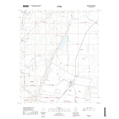
2018 Map of Mer Rouge
USGS Topo · Published 2018About this map
Mer Rouge serves as a focal point in Morehouse Parish, surrounded by a complex network of waterways including Bayou Bartholomew and the intricate channels of The Glades. The landscape transitions from the developed eastern edge of Bastrop to the open expanse of Prairie Mer Rouge, revealing a region shaped by both its agricultural roots and its reliance on the bayou systems. For those studying local history, the map preserves the locations of several burial grounds, such as Dunmore Cem and Mer Rouge Cem, alongside small rural settlements like Stampley and Galion. Transport and local commerce are evident through the Arkla Flyers Inc Airport and the dense web of parish roads, while family-named routes like Sonny Boy Yeldell Rd and Fancher Rd provide a clear view of land division and local habitation in the modern era.
Find a feature on this map
82 named features on this map. Tap any name to fly to it.
Don’t see what you’re looking for? This feature index may not catch every label — zoom into the map to look around manually.
Map Details
Editions of this 2018 Mer Rouge Map
This is the sole edition of this map. No revisions or reprints were ever made.
Other maps of this area

1935 · Collinston
USGS Topo · 1:62,500

1935 · Naff
USGS Topo · 1:62,500

1935 · Hurricane
USGS Topo · 1:62,500

1935 · Bonita
USGS Topo · 1:62,500

1955 · Jackson
USGS Topo · 1:250,000

1956 · Bastrop
USGS Topo · 1:62,500

1957 · Collinston
USGS Topo · 1:62,500

1958 · Hurricane
USGS Topo · 1:62,500

1958 · Bonita
USGS Topo · 1:62,500

1961 · Jackson
USGS Topo · 1:250,000