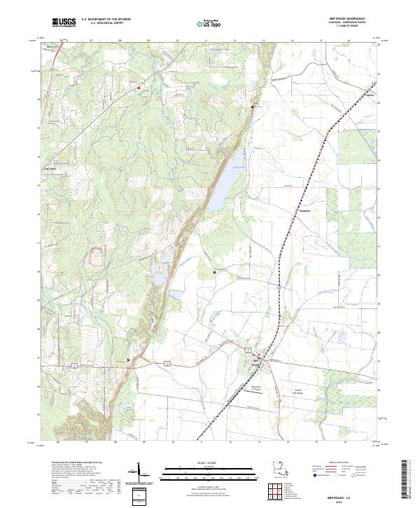
2024 Map of Mer Rouge
USGS Topo · Published 2024About this map
Handy Brake National Wildlife Refuge and the surrounding agricultural bottomlands of Morehouse Parish define this landscape, where the meandering Bayou Bartholomew cuts through a network of smaller waterways like Bayou de Glaise and Cypress Bayou. The settlement of Mer Rouge serves as a local hub, situated near Prairie Mer Rouge and characterized by a grid of streets including Oklahoma St and Arkansas St. Genealogists can locate several burial grounds across the area, such as Mer Rouge Cem and the Lake Cem near Handy Brake. Small hamlets like Stampley, Galion, and Log Cabin are connected by a web of local routes like Crossett Rd and Mer Rouge Rd, while aviation history is noted at the Arkla Flyers Inc Airport.
Find a feature on this map
88 named features on this map. Tap any name to fly to it.
Don’t see what you’re looking for? This feature index may not catch every label — zoom into the map to look around manually.
Map Details
Editions of this 2024 Mer Rouge Map
This is the sole edition of this map. No revisions or reprints were ever made.
Other maps of this area

1935 · Collinston
USGS Topo · 1:62,500

1935 · Naff
USGS Topo · 1:62,500

1935 · Hurricane
USGS Topo · 1:62,500

1935 · Bonita
USGS Topo · 1:62,500

1955 · Jackson
USGS Topo · 1:250,000

1956 · Bastrop
USGS Topo · 1:62,500

1957 · Collinston
USGS Topo · 1:62,500

1958 · Hurricane
USGS Topo · 1:62,500

1958 · Bonita
USGS Topo · 1:62,500

1961 · Jackson
USGS Topo · 1:250,000