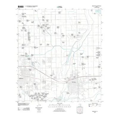
2010 Map of Mercedes
USGS Topo · Published 2010About this map
Arroyo Colorado and the Arroyo Anacuitas define the southern landscape of this region, winding through a dense patchwork of colonias. The area is characterized by an intricate grid of agricultural miles, such as Mile 12 N and Mile 8 N, which organize the numerous residential clusters including Country Village Colonia Number 1 and The Highlands Colonia. This period shows the significant role of local aviation, with the Mid Valley Airport and the specialized Flying 'K' Ranch Ultralight Airport serving the Rio Grande Valley.
Find a feature on this map
126 named features on this map. Tap any name to fly to it.
Don’t see what you’re looking for? This feature index may not catch every label — zoom into the map to look around manually.
Map Details
Editions of this 2010 Mercedes Map
This is the sole edition of this map. No revisions or reprints were ever made.
Other maps of this area

1914 · San Juan
USGS Topo · 1:48,000

1916 · San Juan
USGS Topo · 1:62,500

1929 · Santa Rosa
USGS Topo · 1:24,000

1929 · Santa Maria
USGS Topo · 1:24,000

1929 · La Feria
USGS Topo · 1:24,000

1933 · Santa Rosa
USGS Topo · 1:31,680

1936 · La Feria
USGS Topo · 1:31,680

1936 · Santa Maria
USGS Topo · 1:31,680

1949 · Mc Allen
USGS Topo · 1:250,000

1953 · Brownsville
USGS Topo · 1:250,000
Featured Places
- Weslaco, TX
- Mercedes, TX
- Olivarez Number 2 Colonia, TX
- Southern Valley Estates Colonia, TX
- Olivarez Number 10 Colonia, TX