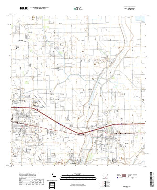
2022 Map of Mercedes
USGS Topo · Published 2022About this map
Weslaco and Mercedes form the urban core of this South Texas landscape, defined by a rigid grid of agricultural roads that stretch toward the Arroyo Colorado. The geography is shaped by the water management systems of the Rio Grande Valley, including the prominent North Floodway and the Valley Acres Reservoir. These engineered features serve a region where industrial and residential growth occurs alongside deep-rooted community foundations. Numerous cemeteries, such as Campacuas Memorial Cem and Our Lady of Mercy Catholic Cem, are clustered throughout the area, reflecting the long-standing family histories of the surrounding settlements. Aviation history and utility are also evident through the presence of the Mid Valley Airport and the smaller Old Reb Airport to the east. This modern survey illustrates how irrigation and transportation infrastructure continue to underpin the development of the Borderlands.
Find a feature on this map
41 named features on this map. Tap any name to fly to it.
Don’t see what you’re looking for? This feature index may not catch every label — zoom into the map to look around manually.
Map Details
Editions of this 2022 Mercedes Map
This is the sole edition of this map. No revisions or reprints were ever made.
Other maps of this area

1914 · San Juan
USGS Topo · 1:48,000

1916 · San Juan
USGS Topo · 1:62,500

1929 · Santa Rosa
USGS Topo · 1:24,000

1929 · Santa Maria
USGS Topo · 1:24,000

1929 · La Feria
USGS Topo · 1:24,000

1933 · Santa Rosa
USGS Topo · 1:31,680

1936 · La Feria
USGS Topo · 1:31,680

1936 · Santa Maria
USGS Topo · 1:31,680

1949 · Mc Allen
USGS Topo · 1:250,000

1953 · Brownsville
USGS Topo · 1:250,000
Featured Places
- Weslaco, TX
- Mercedes, TX
- Olivarez Number 2 Colonia, TX
- Southern Valley Estates Colonia, TX
- Olivarez Number 10 Colonia, TX