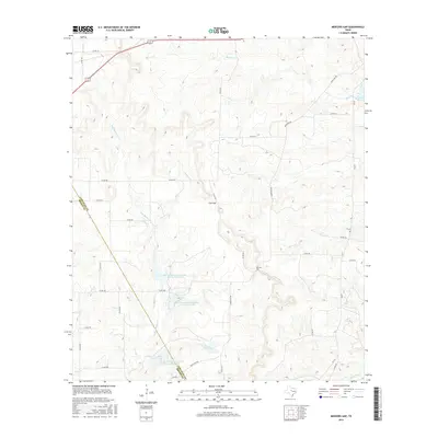
2016 Map of Mercers Gap
USGS Topo · Published 2016About this map
The divide between Comanche Co and Brown Co marks the western edge of this 2016 topographical landscape. Defined by the breaks of the Lampasas Cut Plain, the terrain is anchored by two prominent natural passes: Cox Gap and Mercers Gap. The drainage patterns here are complex, with the headwaters of Mercer Cr and Moore Cr carving through the limestone hills, while Dry Blanket Cr winds southward toward the Leon River.
Find a feature on this map
37 named features on this map. Tap any name to fly to it.
Don’t see what you’re looking for? This feature index may not catch every label — zoom into the map to look around manually.
Map Details
Editions of this 2016 Mercers Gap Map
This is the sole edition of this map. No revisions or reprints were ever made.
Other maps of this area

1889 · Brownwood
USGS Topo · 1:125,000

1894 · Brownwood
USGS Topo · 1:125,000

1928 · Zephyr
USGS Topo · 1:62,500

1931 · Mullin
USGS Topo · 1:62,500

1950 · Zephyr
USGS Topo · 1:62,500

1950 · Mullin
USGS Topo · 1:62,500

1954 · Brownwood
USGS Topo · 1:250,000

1966 · Star Mountain
USGS Topo · 1:24,000
1966 · Blanket
USGS Topo · 1:24,000
1969 · Sidney
USGS Topo · 1:24,000