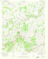
1969 Map of Sidney
USGS Topo · Published 1972About this map
The settlement of Sidney sits at the heart of this North Central Texas landscape, where several winding waterways converge. Tributaries including Jimmys Creek, Sweetwater Creek, and Martins Creek carve through the terrain, flanked by the prominent elevations of Long Mountain and Round Mountain. The map reveals a rural economy shaped by both agriculture and resource extraction, with numerous Oil Wells and Gas Wells scattered across the northwestern quadrant, while the southern reach is defined by the corridor of the Atchison Topeka and Santa Fe railroad. Local history is deeply embedded in the land through family-named sites such as Cox Cem, Pendergrass Cem, and Ferrill Cem, which provide specific points of interest for genealogists tracking early Comanche County residents. The presence of Dudley Airfield and a Radio Tower indicates the mid-century modernization of this traditional ranching and oil-producing region.
Find a feature on this map
21 named features on this map. Tap any name to fly to it.
Don’t see what you’re looking for? This feature index may not catch every label — zoom into the map to look around manually.
Map Details
Editions of this 1969 Sidney Map
This is the sole edition of this map. No revisions or reprints were ever made.
Other maps of this area

1889 · Brownwood
USGS Topo · 1:125,000

1894 · Eastland
USGS Topo · 1:125,000

1894 · Brownwood
USGS Topo · 1:125,000

1954 · Brownwood
USGS Topo · 1:250,000

1954 · Abilene
USGS Topo · 1:250,000

1958 · Abilene
USGS Topo · 1:250,000

1966 · Star Mountain
USGS Topo · 1:24,000

1966 · Sipe Springs
USGS Topo · 1:24,000
1966 · Blanket
USGS Topo · 1:24,000
1969 · Duster
USGS Topo · 1:24,000