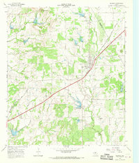
1966 Map of Blanket
USGS Topo · Published 1969About this map
Blanket stands as the central hub of this Central Texas landscape during the late 1960s, situated at the junction of Highway 67 377 and the Atchison Topeka and Santa Fe railroad line. The settlement pattern here is characterized by small, family-centric locales like Logan Valley and Nabers, often centered around community landmarks such as Union Church. The terrain is marked by the prominent Salt Mountain to the north and the winding paths of Blanket Creek and Salt Creek, which are punctuated by numerous small dams and areas subject to controlled inundation. Local industry and recreation are evident through the presence of several Gravel Pits and the Rodeo Ground and Athletic Field located just south of the main town site. For genealogists, the map is particularly useful for locating smaller burial grounds like Antioch Cemetery, Eureka Cemetery, and Moro Cemetery.
Find a feature on this map
24 named features on this map. Tap any name to fly to it.
Don’t see what you’re looking for? This feature index may not catch every label — zoom into the map to look around manually.
Map Details
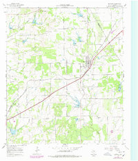
Editions of this 1966 Blanket Map
2 editions found
Other maps of this area

1889 · Brownwood
USGS Topo · 1:125,000

1894 · Brownwood
USGS Topo · 1:125,000

1925 · Brownwood 3-b
USGS Topo · 1:48,000

1928 · Zephyr
USGS Topo · 1:62,500

1931 · Mullin
USGS Topo · 1:62,500

1950 · Zephyr
USGS Topo · 1:62,500

1950 · Mullin
USGS Topo · 1:62,500

1954 · Brownwood
USGS Topo · 1:250,000
1966 · Owens
USGS Topo · 1:24,000
1966 · May
USGS Topo · 1:24,000