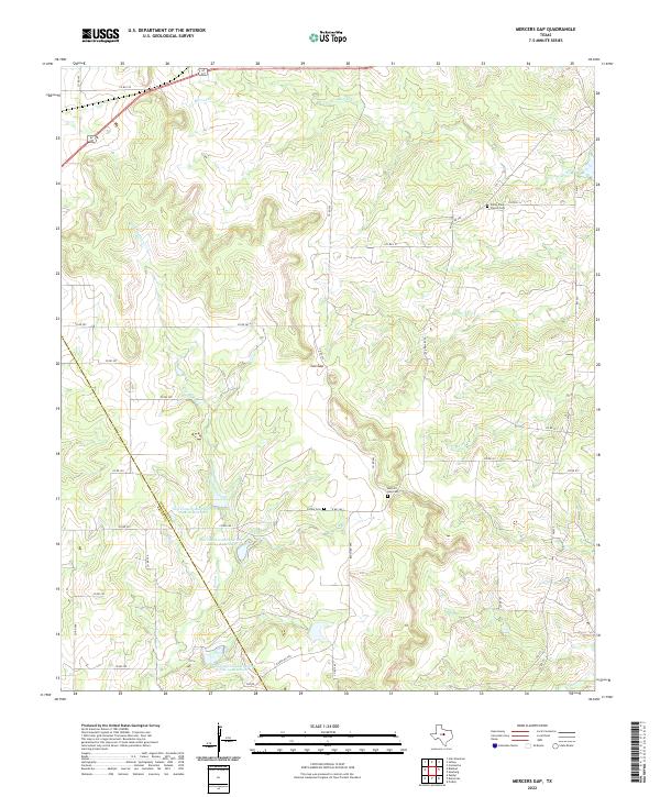
2022 Map of Mercers Gap
USGS Topo · Published 2022About this map
Cox Gap and the surrounding rangeland of the Central Texas hills are defined by a complex drainage network where Mercer Cr and Dry Blanket Cr carve deep through the terrain. This landscape, straddling the Comanche and Brown county line, centers on the small historic community hub near Mercers Gap Cem. The area reflects a reliance on water management, evidenced by several catchments including the Soil Conservation Service Site 12 Reservoir and Site 13 Reservoir that dot the tributaries feeding into the S Leon River. Genealogists and local historians can trace family ties through established burial grounds such as Caffey Cem and the White Point Church Cem, which anchor the rural road network of ranch roads and county routes like FM 590 and FM 573.
Find a feature on this map
38 named features on this map. Tap any name to fly to it.
Don’t see what you’re looking for? This feature index may not catch every label — zoom into the map to look around manually.
Map Details
Editions of this 2022 Mercers Gap Map
This is the sole edition of this map. No revisions or reprints were ever made.
Other maps of this area

1889 · Brownwood
USGS Topo · 1:125,000

1894 · Brownwood
USGS Topo · 1:125,000

1928 · Zephyr
USGS Topo · 1:62,500

1931 · Mullin
USGS Topo · 1:62,500

1950 · Zephyr
USGS Topo · 1:62,500

1950 · Mullin
USGS Topo · 1:62,500

1954 · Brownwood
USGS Topo · 1:250,000

1966 · Star Mountain
USGS Topo · 1:24,000
1966 · Blanket
USGS Topo · 1:24,000
1969 · Sidney
USGS Topo · 1:24,000