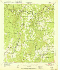
1950 Map of Mercury
USGS Topo · Published 1950About this map
The Colorado River carves a deep, winding path through the heart of this Central Texas landscape, serving as the primary boundary between McCulloch, Brown, and San Saba counties. This mid-century survey reveals a rural economy shaped by rugged topography and reliable water sources, with settlements like Mercury and Winchell positioned along the vital Gulf Colorado And Santa Fe railway corridor. The interior is defined by several prominent elevations, including Lost Mountain, High Lonesome, and Pack Saddle Hill, which overlook a network of tributary drainages such as Deep Creek and Bull Creek.
Find a feature on this map
52 named features on this map. Tap any name to fly to it.
Don’t see what you’re looking for? This feature index may not catch every label — zoom into the map to look around manually.
Map Details
Editions of this 1950 Mercury Map
2 editions found

Other maps of this area

1885 · San Saba
USGS Topo · 1:125,000

1887 · Coleman
USGS Topo · 1:125,000

1889 · Brownwood
USGS Topo · 1:125,000

1889 · Coleman
USGS Topo · 1:125,000

1894 · Brady
USGS Topo · 1:125,000

1894 · Brownwood
USGS Topo · 1:125,000

1894 · San Saba
USGS Topo · 1:125,000

1924 · Brady 2-a
USGS Topo · 1:48,000

1925 · Brady 1-b
USGS Topo · 1:48,000

1925 · Brady 1-a
USGS Topo · 1:48,000