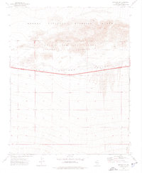
1973 Map of Mercury SE
USGS Topo · Published 1976About this map
The Desert National Wildlife Range and Nellis Air Force Range dominate this 1970s landscape in Clark County, revealing a territory defined by conservation and military utility. The map shows the Wildlife Military Reservation Boundary cutting through the northern terrain, where the high desert transitions into the Indian Springs Valley. Infrastructure is sparse, primarily concentrated along the route of Highway 95, which traverses the Depression. Evidence of resource extraction and geological study is visible through several Borrow Pits and a Drill Hole scattered near the roadway. To the south, the terrain descends toward Willow Creek, providing a stark contrast to the arid northern uplands. This survey documents the intersection of public lands and defense infrastructure in the Nevada desert during the early 1970s.
Find a feature on this map
14 named features on this map. Tap any name to fly to it.
Don’t see what you’re looking for? This feature index may not catch every label — zoom into the map to look around manually.
Map Details
Editions of this 1973 Mercury SE Map
2 editions found
Other maps of this area

1907 · Las Vegas
USGS Topo · 1:250,000

1908 · Las Vegas
USGS Topo · 1:250,000

1942 · Indian Spring
USGS Topo · 1:125,000

1952 · Mercury
USGS Topo · 1:62,500

1954 · Las Vegas
USGS Topo · 1:250,000

1957 · Las Vegas
USGS Topo · 1:250,000

1957 · Mt. Stirling
USGS Topo · 1:62,500

1957 · Charleston Peak
USGS Topo · 1:62,500

1959 · Las Vegas
USGS Topo · 1:250,000
1961 · Mercury
USGS Topo · 1:24,000