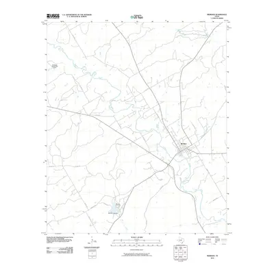
2010 Map of Meridian
USGS Topo · Published 2010About this map
Meridian serves as the central hub for this portion of Bosque County, where the North Bosque River winds through the landscape. The town's grid is oriented towards the river, with significant local infrastructure illustrated by the Meridian Lake Dam and the B E Farrell Lake Number 2 Dam. The intersection of state and county roads, such as St Park Rd 7 and Farm Rd 1473, highlights the transit network connecting the town to recreational areas. To the southwest, Meridian State Park occupies a significant portion of the terrain, centered around its namesake lake and the headwaters of Bee Creek. The geography is defined by a series of waterways, including Gibson Branch and Dyes Branch, which drain the surrounding rural lands. This map captures the relationship between the established town site and the managed water resources and parklands that characterize the region.
Find a feature on this map
26 named features on this map. Tap any name to fly to it.
Don’t see what you’re looking for? This feature index may not catch every label — zoom into the map to look around manually.
Map Details
Editions of this 2010 Meridian Map
This is the sole edition of this map. No revisions or reprints were ever made.
Other maps of this area

1888 · Meridian
USGS Topo · 1:125,000

1889 · Granbury
USGS Topo · 1:125,000

1894 · Meridian
USGS Topo · 1:125,000

1931 · Morgan
USGS Topo · 1:62,500

1954 · Dallas
USGS Topo · 1:250,000

1954 · Waco
USGS Topo · 1:250,000

1955 · Waco
USGS Topo · 1:250,000

1955 · Clifton
USGS Topo · 1:24,000

1955 · Meridian
USGS Topo · 1:24,000
1955 · Pilot Knob
USGS Topo · 1:24,000