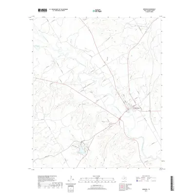
2019 Map of Meridian
USGS Topo · Published 2019About this map
Meridian stands as the primary hub of this Bosque County landscape, situated at the confluence of several regional routes and the winding North Bosque River. The topography is defined by the sharp incisions of the Bee Creek and Gibson Branch drainages, which carve through the limestone-inflected terrain characteristic of this part of Central Texas. Southwest of the town center, the Meridian Lake reservoir and the adjacent Shinnery Ridge Trail offer a look at the area's recreational geography, where the upland ridges overlook the river valley below.
Find a feature on this map
59 named features on this map. Tap any name to fly to it.
Don’t see what you’re looking for? This feature index may not catch every label — zoom into the map to look around manually.
Map Details
Editions of this 2019 Meridian Map
This is the sole edition of this map. No revisions or reprints were ever made.
Other maps of this area

1888 · Meridian
USGS Topo · 1:125,000

1889 · Granbury
USGS Topo · 1:125,000

1894 · Meridian
USGS Topo · 1:125,000

1931 · Morgan
USGS Topo · 1:62,500

1954 · Dallas
USGS Topo · 1:250,000

1954 · Waco
USGS Topo · 1:250,000

1955 · Waco
USGS Topo · 1:250,000

1955 · Clifton
USGS Topo · 1:24,000

1955 · Meridian
USGS Topo · 1:24,000
1955 · Pilot Knob
USGS Topo · 1:24,000