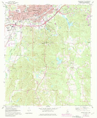
1971 Map of Meridian South
USGS Topo · Published 1982About this map
Meridian spreads across the northern reaches of this landscape, its urban fabric defined by a dense network of civic landmarks including the Po, City Hall, and numerous education centers like Harris High Sch and Wechsler Sch. The city's industrial and transit history is etched into the terrain through the corridors of the Southern and Illinois Central Gulf railroads, which bypass the massive municipal aviation facility at Key Field.
Find a feature on this map
64 named features on this map. Tap any name to fly to it.
Don’t see what you’re looking for? This feature index may not catch every label — zoom into the map to look around manually.
Map Details
Editions of this 1971 Meridian South Map
2 editions found
Other maps of this area

1921 · Meridian
USGS Topo · 1:48,000

1923 · Meridian
USGS Topo · 1:62,500

1953 · Meridian
USGS Topo · 1:250,000

1957 · Meridian
USGS Topo · 1:250,000

1957 · Chunky
USGS Topo · 1:62,500

1957 · Quitman
USGS Topo · 1:62,500

1957 · Enterprise
USGS Topo · 1:62,500

1965 · Meridian
USGS Topo · 1:250,000

1971 · Vimville
USGS Topo · 1:24,000

1971 · Meridian South
USGS Topo · 1:24,000