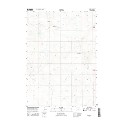
2015 Map of Merino
USGS Topo · Published 2015About this map
Merino and the surrounding high plains of Natrona County are defined by an intricate network of drainage draws and small water catchments essential for ranching in this arid environment. The landscape is carved by Castle Cr and its tributary, S Fork Castle Cr, while numerous named depressions like Austin Draw and Hemingway Draw navigate the undulating terrain. A significant number of localized water features, including Thirtythree Mile Reservoir and N Thirtythree Mile Reservoir, underscore the importance of water management in this portion of Wyoming. Remote access is provided by unpaved routes such as Divide Rd and CR-114, which traverse the high ground between watersheds. This 2015 survey illustrates how contemporary land use remains tied to these vital water sources, providing a clear record of the physical geography used by local livestock operations.
Find a feature on this map
19 named features on this map. Tap any name to fly to it.
Don’t see what you’re looking for? This feature index may not catch every label — zoom into the map to look around manually.
Map Details
Editions of this 2015 Merino Map
This is the sole edition of this map. No revisions or reprints were ever made.
Other maps of this area

1955 · Arminto
USGS Topo · 1:250,000

1958 · Arminto
USGS Topo · 1:250,000

1962 · Arminto
USGS Topo · 1:250,000

1968 · Big Gulch
USGS Topo · 1:24,000

1968 · Merino
USGS Topo · 1:24,000

1968 · Illco
USGS Topo · 1:24,000
1968 · Statzer Point
USGS Topo · 1:24,000

1968 · Camel Hump Reservoir
USGS Topo · 1:24,000

1968 · Reynolds Reservoir
USGS Topo · 1:24,000

1968 · Fiftymile Flat
USGS Topo · 1:24,000