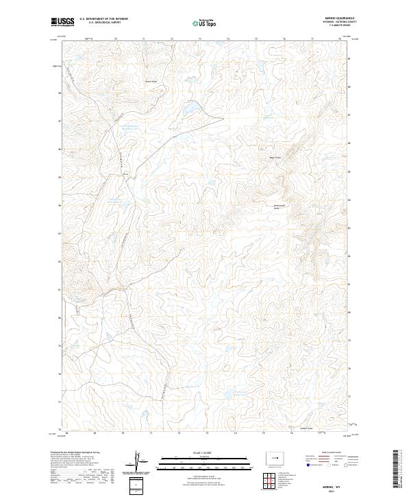
2021 Map of Merino
USGS Topo · Published 2021About this map
Merino and the surrounding ranchlands of Natrona County appear as a landscape defined by water management and remote access roads in the early 21st century. The terrain is marked by seasonal drainages and man-made impoundments, most notably the Thirtythree Mile Reservoir and its companion, North Thirtythree Mile Reservoir, which serve as vital water sources in this arid stretch of the state. Other water features such as Bayer Reservoir and the uniquely named 9 H 6 Number 2 Reservoir underscore the area's agricultural and livestock-focused utility.
Find a feature on this map
19 named features on this map. Tap any name to fly to it.
Don’t see what you’re looking for? This feature index may not catch every label — zoom into the map to look around manually.
Map Details
Editions of this 2021 Merino Map
This is the sole edition of this map. No revisions or reprints were ever made.
Other maps of this area

1955 · Arminto
USGS Topo · 1:250,000

1958 · Arminto
USGS Topo · 1:250,000

1962 · Arminto
USGS Topo · 1:250,000

1968 · Big Gulch
USGS Topo · 1:24,000

1968 · Merino
USGS Topo · 1:24,000

1968 · Illco
USGS Topo · 1:24,000
1968 · Statzer Point
USGS Topo · 1:24,000

1968 · Camel Hump Reservoir
USGS Topo · 1:24,000

1968 · Reynolds Reservoir
USGS Topo · 1:24,000

1968 · Fiftymile Flat
USGS Topo · 1:24,000