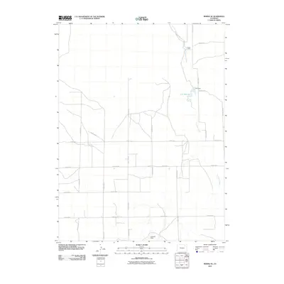
2010 Map of Merino SE
USGS Topo · Published 2010About this map
Fremont Butte rises above the high plains of Washington County, anchoring a landscape defined by an extensive grid of section-line roads and the winding path of Twentytwo Slough. This 2010 survey by the U.S. Geological Survey shows a rural environment where land use revolves around ranching and water management. To the north, the Flying Y J Ranch sits near the slough, while the eastern portion of the map is punctuated by irrigation infrastructure including the A-27 Reservoir and its associated A-27 Dam. The map's dense network of routes, such as County Road Y and County Road W, illustrates the organized expansion of rural connectivity across this part of Colorado. This document provides a clear view of contemporary Western land divisions and the persistence of family-named agricultural operations.
Find a feature on this map
18 named features on this map. Tap any name to fly to it.
Don’t see what you’re looking for? This feature index may not catch every label — zoom into the map to look around manually.
Map Details
Editions of this 2010 Merino SE Map
This is the sole edition of this map. No revisions or reprints were ever made.
Other maps of this area

1951 · Messex
USGS Topo · 1:24,000

1951 · Merino SW
USGS Topo · 1:24,000

1951 · Merino SE
USGS Topo · 1:24,000

1951 · Merino
USGS Topo · 1:24,000

1954 · Sterling
USGS Topo · 1:250,000

1958 · Sterling
USGS Topo · 1:250,000

1971 · Messex
USGS Topo · 1:24,000

1971 · Merino
USGS Topo · 1:24,000

1973 · Akron
USGS Topo · 1:24,000

1973 · Buffalo Springs Ranch NW
USGS Topo · 1:24,000