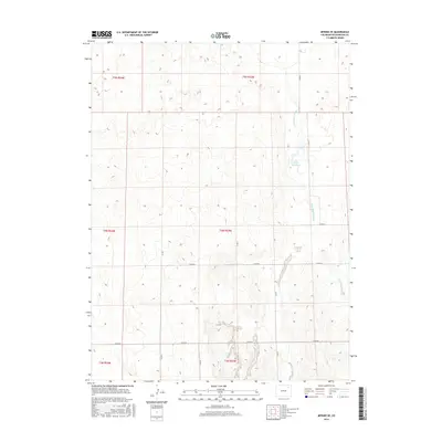
2016 Map of Merino SE
USGS Topo · Published 2016About this map
Twentytwo Slough meanders across the eastern plains of Washington County, Colorado, defining a landscape dominated by the Public Land Survey System's rigid grid. This 2016 survey by the U.S. Geological Survey illustrates the intersection of natural hydrology and human-imposed infrastructure in an area largely dedicated to agriculture and livestock. The A-27 Reservoir serves as a primary water management feature, positioned among the undulating contours of the High Plains. A network of county roads, including the primary east-west corridor of Co RD 50 and north-south routes like Co RD Y and Co RD Z, provide the essential framework for transit through this sparsely populated region. The map preserves the specific township and range boundaries, such as t4n r53w, which have dictated land ownership and usage since the era of original homesteading.
Find a feature on this map
16 named features on this map. Tap any name to fly to it.
Don’t see what you’re looking for? This feature index may not catch every label — zoom into the map to look around manually.
Map Details
Editions of this 2016 Merino SE Map
This is the sole edition of this map. No revisions or reprints were ever made.
Other maps of this area

1951 · Messex
USGS Topo · 1:24,000

1951 · Merino SW
USGS Topo · 1:24,000

1951 · Merino SE
USGS Topo · 1:24,000

1951 · Merino
USGS Topo · 1:24,000

1954 · Sterling
USGS Topo · 1:250,000

1958 · Sterling
USGS Topo · 1:250,000

1971 · Messex
USGS Topo · 1:24,000

1971 · Merino
USGS Topo · 1:24,000

1973 · Akron
USGS Topo · 1:24,000

1973 · Buffalo Springs Ranch NW
USGS Topo · 1:24,000