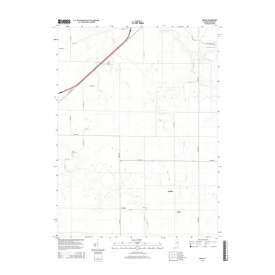
2015 Map of Merna
USGS Topo · Published 2015About this map
Merna Cem and the surrounding farmland of McLean County reflect a landscape defined by an orderly grid of rural roads and prairie waterways. Situated east of Bloomington, this area is characterized by the meandering courses of Money Cr and the Mackinaw River, which break the geometric precision of the township road system. The settlement of Fletcher and the P.J. Killian Airport serve as local landmarks alongside several generational burial grounds, including Smith Grove Cem and Pleasant Hill Cem. A notable geographic contrast exists between the flat agricultural fields and the prominent rise of Blue Mound to the southeast. Transportation history is evidenced by the path of Old Route 66, which cuts diagonally across the northwestern corner of the quadrangle, mirroring the modern interstate alignment while marking the legacy of early transcontinental travel.
Find a feature on this map
28 named features on this map. Tap any name to fly to it.
Don’t see what you’re looking for? This feature index may not catch every label — zoom into the map to look around manually.
Map Details
Editions of this 2015 Merna Map
This is the sole edition of this map. No revisions or reprints were ever made.
Other maps of this area

1926 · Normal
USGS Topo · 1:62,500

1930 · Normal
USGS Topo · 1:62,500

1951 · Le Roy
USGS Topo · 1:62,500

1952 · Arrowsmith
USGS Topo · 1:62,500

1957 · Colfax
USGS Topo · 1:62,500

1958 · Peoria
USGS Topo · 1:250,000

1961 · Peoria
USGS Topo · 1:250,000

1963 · Peoria
USGS Topo · 1:250,000
1981 · Holder
USGS Topo · 1:24,000

1981 · Lexington
USGS Topo · 1:24,000