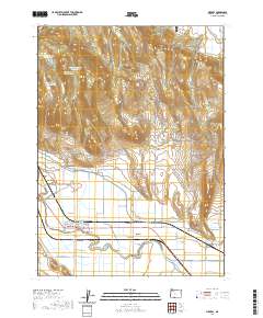
2020 Map of Merrill
USGS Topo · Published 2020About this map
The town of Merrill anchors this 2020 landscape in Klamath County, where the southern Klamath Basin’s sophisticated irrigation network is on full display. The settlement sits just north of the winding Lost River, surrounded by a grid of vital waterways including the G-Three Canal, D Canal, and Van Brimmer Canal. These systems transform the arid basin floor, supporting the agricultural economy and connecting the town to the broader regional hydrology.
Find a feature on this map
46 named features on this map. Tap any name to fly to it.
Don’t see what you’re looking for? This feature index may not catch every label — zoom into the map to look around manually.
Map Details
Editions of this 2020 Merrill Map
This is the sole edition of this map. No revisions or reprints were ever made.
Other maps of this area

1886 · Modoc Lava Bed
USGS Topo · 1:250,000

1889 · Klamath
USGS Topo · 1:250,000

1892 · Modoc Lava-Bed
USGS Topo · 1:250,000

1894 · Klamath
USGS Topo · 1:250,000

1950 · Mt. Dome
USGS Topo · 1:62,500

1951 · Tulelake
USGS Topo · 1:62,500

1954 · Alturas
USGS Topo · 1:250,000

1955 · Klamath Falls
USGS Topo · 1:250,000

1957 · Merrill
USGS Topo · 1:62,500

1957 · Malin
USGS Topo · 1:62,500