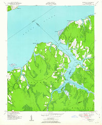
1951 Map of Merrimon
USGS Topo · Published 1951About this map
The Neuse River and Intracoastal Waterway define the coastal landscape of this peninsula where Craven, Carteret, and Pamlico counties converge. In the early post-war era, the settlement of Merrimon serves as a focal point for a community deeply tied to the surrounding waters and low-lying marshes. The interior is characterized by a network of rural landmarks, including Merrimon Ch, Reels Chapel, and Antioch Ch, which suggest established family clusters and community centers throughout Merrimon Township No 5.
Find a feature on this map
44 named features on this map. Tap any name to fly to it.
Don’t see what you’re looking for? This feature index may not catch every label — zoom into the map to look around manually.
Map Details
Editions of this 1951 Merrimon Map
2 editions found
Other maps of this area

1948 · Oriental
USGS Topo · 1:24,000

1949 · Merrimon
USGS Topo · 1:24,000

1949 · Newport
USGS Topo · 1:24,000

1949 · Williston
USGS Topo · 1:24,000

1949 · South River
USGS Topo · 1:24,000

1949 · Cherry Point
USGS Topo · 1:24,000

1949 · Core Creek
USGS Topo · 1:24,000

1950 · South River
USGS Topo · 1:24,000

1950 · Arapahoe
USGS Topo · 1:24,000

1951 · Williston
USGS Topo · 1:24,000