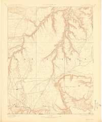
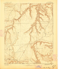
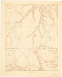
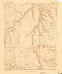
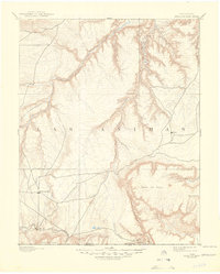
1893 Map of Mesa De Maya
USGS Topo · Published 1909About this map
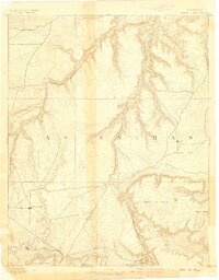
Las Animas County territory in southeastern Colorado is dominated by the massive plateau of Mesa De Maya, which stretches across the southern portion of this 1890s survey. The landscape is defined by a network of deep erosional features, including the sprawling Chaquaqua Canyon and Water Canyon, which drain northward toward the Purgatoire River. The drainage patterns, such as Alkali Arroyo and Tinaja Creek, illustrate the complex topography that early settlers navigated along the Colorado-New Mexico border.
Find a feature on this map
23 named features on this map. Tap any name to fly to it.
Don’t see what you’re looking for? This feature index may not catch every label — zoom into the map to look around manually.
Map Details
Editions of this 1893 Mesa De Maya Map
6 editions found
Other maps of this area

1891 · Higbee
USGS Topo · 1:125,000

1891 · Timpas
USGS Topo · 1:125,000

1891 · Apishapa
USGS Topo · 1:125,000

1891 · Mesa De Maya
USGS Topo · 1:125,000

1892 · Elmoro
USGS Topo · 1:125,000

1892 · Mt Carrizo
USGS Topo · 1:125,000

1893 · Higbee
USGS Topo · 1:125,000

1893 · Apishapa
USGS Topo · 1:125,000

1893 · Elmoro
USGS Topo · 1:125,000
1893 · Mesa de Maya
USGS Topo · 1:125,000