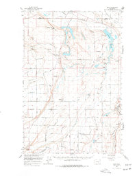
1965 Map of Mesa
USGS Topo · Published 1978About this map
Potholes Canal and an extensive network of siphons, aqueducts, and pumping stations dominate this mid-century landscape, illustrating the massive irrigation efforts of the U.S. Bureau of Reclamation in Franklin County. The map captures a moment of agricultural and infrastructure transition, where planned settlements like Basin City and the Bailie Memorial Boys Ranch are surrounded by a rigid grid of roads named for trees and flora, such as Chestnut Road and Bellflower Road.
Find a feature on this map
50 named features on this map. Tap any name to fly to it.
Don’t see what you’re looking for? This feature index may not catch every label — zoom into the map to look around manually.
Map Details
Editions of this 1965 Mesa Map
2 editions found

Other maps of this area

1915 · Wallulah
USGS Topo · 1:96,000

1916 · Connell
USGS Topo · 1:125,000

1917 · Pasco
USGS Topo · 1:125,000

1918 · Connell
USGS Topo · 1:125,000

1918 · Wallula
USGS Topo · 1:125,000

1923 · Corfu
USGS Topo · 1:62,500

1924 · Othello
USGS Topo · 1:62,500

1924 · Hanford
USGS Topo · 1:62,500

1925 · Scooteney Lake
USGS Topo · 1:62,500

1951 · Scooteney Lake
USGS Topo · 1:62,500