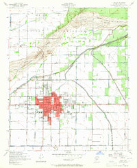
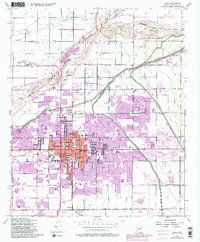
1952 Map of Mesa
USGS Topo · Published 1965About this map
Mesa appears here as a growing desert hub in the early 1950s, defined by its complex irrigation network and civic infrastructure. The city center is densely packed with local institutions such as High Sch, Irving Sch, and Webster Sch, while the surrounding landscape reflects the agricultural legacy of the Salt River Valley. To the north, the Salt River Indian Reservation marks a distinct transition in land use, featuring the Salt River Indian Day Sch and Salt River Reservation Clinic.
Find a feature on this map
34 named features on this map. Tap any name to fly to it.
Don’t see what you’re looking for? This feature index may not catch every label — zoom into the map to look around manually.
Map Details
Editions of this 1952 Mesa Map
5 editions found
Other maps of this area

1904 · Camelback
USGS Topo · 1:62,500

1904 · Desert Well
USGS Topo · 1:62,500

1904 · Ft. McDowell
USGS Topo · 1:62,500

1906 · Camelsback
USGS Topo · 1:62,500

1906 · Ft. McDowell
USGS Topo · 1:62,500

1906 · Desert Well
USGS Topo · 1:62,500

1913 · Mesa
USGS Topo · 1:62,500

1915 · Mesa
USGS Topo · 1:62,500

1930 · Cave Creek
USGS Topo · 1:125,000

1939 · Cave Creek
USGS Topo · 1:125,000