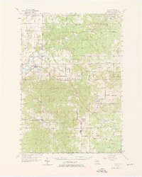
1956 Map of Mesick
USGS Topo · Published 1976About this map
The Manistee River and the Ann Arbor railroad corridor define the geography of this mid-century Wexford County landscape. In the village of Mesick, the river is punctuated by a Dam and Preston Pond, while the surrounding timberlands are managed as part of the Fife Lake State Forest. The map documents a period of rural consolidation, marking several former school sites as already closed, including Cornell Sch, McNett Sch, and the Selma Center Sch.
Find a feature on this map
67 named features on this map. Tap any name to fly to it.
Don’t see what you’re looking for? This feature index may not catch every label — zoom into the map to look around manually.
Map Details
Editions of this 1956 Mesick Map
3 editions found
Other maps of this area

1933 · Peacock NE
USGS Topo · 1:31,680

1933 · Luther NW
USGS Topo · 1:31,680

1954 · Traverse City
USGS Topo · 1:250,000

1956 · Fife Lake
USGS Topo · 1:62,500

1956 · Kingsley
USGS Topo · 1:62,500

1956 · Mesick
USGS Topo · 1:62,500

1956 · Thompsonville
USGS Topo · 1:62,500

1956 · Cadillac North
USGS Topo · 1:62,500

1957 · Cadillac South
USGS Topo · 1:62,500

1957 · Copemish
USGS Topo · 1:62,500