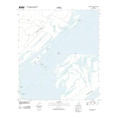
2010 Map of Mesquite Bay
USGS Topo · Published 2010About this map
Mesquite Bay and Ayres Bay dominate this coastal landscape along the Texas Gulf Coast, where shallow waters and intricate reef systems define the maritime environment. The area is characterized by a series of barrier landforms including Matagorda Island and San Jose Island, separated by the namesake bay. Inland, the Blackjack Peninsula provides a stable landmass marked by ranching infrastructure like Jack Windmill and Carlos Windmill, which speak to the area's agricultural history. The complex hydrology of the region is evident in the numerous interconnected water bodies such as Big Brundrett Lake, Mustang Lake, and the winding Cottonwood Bayou. The presence of features like Ayres Reef and the Second Chain of Islands illustrates the shifting, sediment-rich nature of this estuary system where the Gulf meets the coastal mainland.
Find a feature on this map
26 named features on this map. Tap any name to fly to it.
Don’t see what you’re looking for? This feature index may not catch every label — zoom into the map to look around manually.
Map Details
Editions of this 2010 Mesquite Bay Map
This is the sole edition of this map. No revisions or reprints were ever made.
Other maps of this area

1952 · Mosquito Point
USGS Topo · 1:24,000

1952 · St. Charles Bay SW
USGS Topo · 1:24,000

1952 · St. Charles Bay
USGS Topo · 1:24,000

1952 · Mesquite Bay
USGS Topo · 1:24,000

1952 · Tivoli SE
USGS Topo · 1:24,000

1952 · Panther Point
USGS Topo · 1:24,000

1952 · Tivoli SW
USGS Topo · 1:24,000

1952 · St. Charles Bay SE
USGS Topo · 1:24,000

1953 · Beeville
USGS Topo · 1:250,000

1956 · Beeville
USGS Topo · 1:250,000