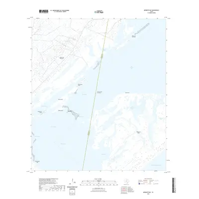
2022 Map of Mesquite Bay
USGS Topo · Published 2022About this map
The Intracoastal Waterway cuts a straight course through the complex coastal geography of the Aransas and Calhoun county border, serving as the primary navigation artery for this maritime landscape. This coastal region is dominated by expansive saltwater bodies and tidal marshes, including Mesquite Bay, San Antonio Bay, and Ayres Bay. The geography is defined by narrow barrier features and peninsulas, most notably the southern reach of the Black Jack Peninsula and the western edge of Matagorda Island. Named features like Ayres Reef and Rattlesnake Reef indicate the shallow, obstacle-strewn nature of these waters, while man-made improvements such as the Belden Dugout and Ayres Dugout show the historical efforts to manage water flow and navigation through the marshes. This map documents a fragile coastal ecosystem where small landforms like the Second Chain of Islands and False Live Oak Point provide critical landmarks for local navigation.
Find a feature on this map
25 named features on this map. Tap any name to fly to it.
Don’t see what you’re looking for? This feature index may not catch every label — zoom into the map to look around manually.
Map Details
Editions of this 2022 Mesquite Bay Map
This is the sole edition of this map. No revisions or reprints were ever made.
Other maps of this area

1952 · Mosquito Point
USGS Topo · 1:24,000

1952 · St. Charles Bay SW
USGS Topo · 1:24,000

1952 · St. Charles Bay
USGS Topo · 1:24,000

1952 · Mesquite Bay
USGS Topo · 1:24,000

1952 · Tivoli SE
USGS Topo · 1:24,000

1952 · Panther Point
USGS Topo · 1:24,000

1952 · Tivoli SW
USGS Topo · 1:24,000

1952 · St. Charles Bay SE
USGS Topo · 1:24,000

1953 · Beeville
USGS Topo · 1:250,000

1956 · Beeville
USGS Topo · 1:250,000