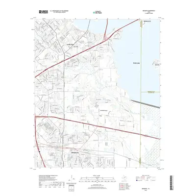
2019 Map of Mesquite
USGS Topo · Published 2019About this map
Mesquite and Garland dominate this part of the eastern Dallas metropolitan area during a period of significant suburban expansion in the late 2010s. The landscape is defined by dense residential networks, yet historical markers like Lyons Cem and Pleasant Ridge Cem persist among the modern developments. The community of Tripp remains identifiable within Sunnyvale, sitting near the drainage of Long Cr. To the southeast, the Mesquite Metro Airport serves as a major logistical landmark. Water features such as Lupton Lake and the E Fork Trinity River provide natural boundaries between the sprawling municipalities. The map captures the complex interaction between established neighborhoods and the remaining open corridors of the Duck Cr and N Mesquite Cr basins.
Find a feature on this map
311 named features on this map. Tap any name to fly to it.
Don’t see what you’re looking for? This feature index may not catch every label — zoom into the map to look around manually.
Map Details
Editions of this 2019 Mesquite Map
This is the sole edition of this map. No revisions or reprints were ever made.
Other maps of this area

1891 · Dallas
USGS Topo · 1:125,000

1893 · Dallas
USGS Topo · 1:125,000

1912 · Rockwall
USGS Topo · 1:31,680

1919 · Royse City
USGS Topo · 1:62,500

1954 · Dallas
USGS Topo · 1:250,000

1956 · Kaufman
USGS Topo · 1:62,500

1957 · White Rock Lake
USGS Topo · 1:24,000

1958 · Dallas
USGS Topo · 1:250,000

1958 · Hutchins
USGS Topo · 1:24,000

1958 · White Rock Lake
USGS Topo · 1:24,000