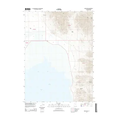
2014 Map of Messix Peak
USGS Topo · Published 2014About this map
Great Salt Lake dominates the western half of this landscape, its waters divided into Gunnison Bay and Rozel Bay. The shoreline meets the rugged eastern terrain of the Promontory Mountains, where high elevations are marked by Mt Tarpey and Messix Peak. This 2014 survey documents a sparsely populated but geographically significant portion of Box Elder County, where the transition from the saline waters of the lake to the high desert peaks is bridged by the low-lying Rozel Flat.
Find a feature on this map
17 named features on this map. Tap any name to fly to it.
Don’t see what you’re looking for? This feature index may not catch every label — zoom into the map to look around manually.
Map Details
Editions of this 2014 Messix Peak Map
This is the sole edition of this map. No revisions or reprints were ever made.
Other maps of this area

1954 · Brigham City
USGS Topo · 1:250,000

1958 · Brigham City
USGS Topo · 1:250,000

1961 · Thatcher Mountain
USGS Topo · 1:62,500

1962 · Brigham City
USGS Topo · 1:250,000

1966 · Thatcher Mountain SW
USGS Topo · 1:24,000

1967 · Golden Spike Monument
USGS Topo · 1:24,000

1967 · East Promontory
USGS Topo · 1:24,000

1968 · Messix Peak
USGS Topo · 1:24,000

1968 · Rozel
USGS Topo · 1:24,000

1968 · Indian Cove
USGS Topo · 1:24,000