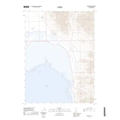
2023 Map of Messix Peak
USGS Topo · Published 2023About this map
Great Salt Lake dominates the southwestern portion of this map, where the waters of Rozel Bay meet the shoreline of Rozel Flat. The terrain transitions sharply from these low-lying wetlands and flats into the dramatic elevations of the Promontory Mountains. Significant landmarks including Messix Peak and Mt Torpey define the high ridges, while deep incisions like Maple Canyon and Broadmouth Canyon drain toward the basin. Human infrastructure is sparse in this arid landscape, centered primarily on the Fort Ranch Airport in the northwest and a few vital water sources such as Rose Spring and Indian Springs. The presence of N Big Valley Rd W indicates the primary corridor through the valley floor, providing a modern perspective on the accessibility of this isolated stretch of the Great Basin.
Find a feature on this map
12 named features on this map. Tap any name to fly to it.
Don’t see what you’re looking for? This feature index may not catch every label — zoom into the map to look around manually.
Map Details
Editions of this 2023 Messix Peak Map
This is the sole edition of this map. No revisions or reprints were ever made.
Other maps of this area

1954 · Brigham City
USGS Topo · 1:250,000

1958 · Brigham City
USGS Topo · 1:250,000

1961 · Thatcher Mountain
USGS Topo · 1:62,500

1962 · Brigham City
USGS Topo · 1:250,000

1966 · Thatcher Mountain SW
USGS Topo · 1:24,000

1967 · Golden Spike Monument
USGS Topo · 1:24,000

1967 · East Promontory
USGS Topo · 1:24,000

1968 · Messix Peak
USGS Topo · 1:24,000

1968 · Rozel
USGS Topo · 1:24,000

1968 · Indian Cove
USGS Topo · 1:24,000