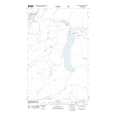
2011 Map of Metaline Falls
USGS Topo · Published 2011About this map
Metaline Falls and the Pend Oreille River define this corner of northeast Washington, where the water flows north toward the border. This 2011 survey documents the complex water management infrastructure around Sullivan Lake, including the Sullivan Lake Dam and the nearby Mill Pond Dam on Sullivan Creek. The geography here is a mix of river-level settlements and high-altitude monitoring stations, such as the Hall Mountain Lookout and Upper Sand Creek Lookout. Transport and utility are centered near the Metaline Falls Post Office and the Sullivan Lake State Airport, while the Pend Oreille River Bridge provides a vital crossing near Washington Rock. The map illustrates how recreational sites like the Noisy Creek Campground and Sullivan Creek Campground Number 1 are situated within a landscape carved by numerous drainages, including Harvey Creek and Pocahontas Creek.
Find a feature on this map
38 named features on this map. Tap any name to fly to it.
Don’t see what you’re looking for? This feature index may not catch every label — zoom into the map to look around manually.
Map Details
Editions of this 2011 Metaline Falls Map
This is the sole edition of this map. No revisions or reprints were ever made.
Other maps of this area

1934 · Metaline
USGS Topo · 1:125,000

1942 · Metaline
USGS Topo · 1:125,000

1958 · Sandpoint
USGS Topo · 1:250,000

1963 · Sandpoint
USGS Topo · 1:250,000

1967 · Gypsy Peak
USGS Topo · 1:24,000

1967 · Ione
USGS Topo · 1:24,000

1967 · Scotchman Lake
USGS Topo · 1:24,000

1967 · Boundary Dam
USGS Topo · 1:24,000

1967 · Metaline
USGS Topo · 1:24,000

1967 · Metaline Falls
USGS Topo · 1:24,000