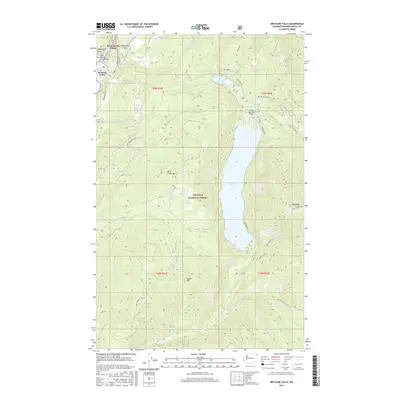
2017 Map of Metaline Falls
USGS Topo · Published 2017About this map
Metaline Falls and the neighboring Washington Village occupy the northwestern corner of this territory, where the Pend Oreille River Bridge spans the water near Washington Rock. The landscape is dominated by the steep elevations of the Colville National Forest, featuring landmarks like Sand Creek Mtn and Hall Mtn. Central to the area is the massive expanse of Sullivan Lake, which is fed by Harvey Cr and Noisy Creek, and regulated at its northern end by Mill Pond. The presence of the Sullivan Lake State Airport and the residential layout at Grandview Flats reflects the modern intersection of wilderness recreation and settlement in this corner of Pend Oreille County. Forest service roads like Nat For Dev Rd 50 wind through the drainages of Maitlen Cr and Paupac Cr, providing access to the high backcountry ridges of Snyder Hill.
Find a feature on this map
43 named features on this map. Tap any name to fly to it.
Don’t see what you’re looking for? This feature index may not catch every label — zoom into the map to look around manually.
Map Details
Editions of this 2017 Metaline Falls Map
This is the sole edition of this map. No revisions or reprints were ever made.
Other maps of this area

1934 · Metaline
USGS Topo · 1:125,000

1942 · Metaline
USGS Topo · 1:125,000

1958 · Sandpoint
USGS Topo · 1:250,000

1963 · Sandpoint
USGS Topo · 1:250,000

1967 · Gypsy Peak
USGS Topo · 1:24,000

1967 · Ione
USGS Topo · 1:24,000

1967 · Scotchman Lake
USGS Topo · 1:24,000

1967 · Boundary Dam
USGS Topo · 1:24,000

1967 · Metaline
USGS Topo · 1:24,000

1967 · Metaline Falls
USGS Topo · 1:24,000