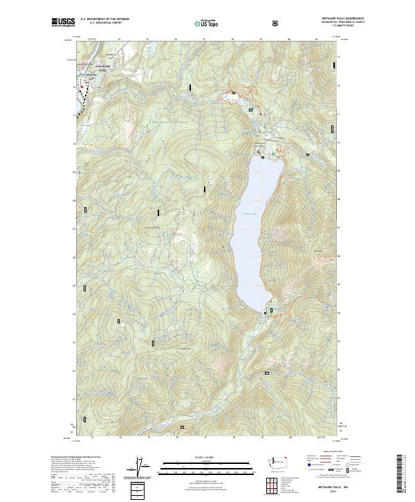
2023 Map of Metaline Falls
USGS Topo · Published 2023About this map
Metaline Falls sits along the Pend Oreille River in this northern Washington landscape, serving as a gateway to the dense timberlands of the Colville National Forest. The geography is dominated by the narrow, deep basin of Sullivan Lake, which is fed and drained by an intricate network of mountain streams including Harvey Creek and Sullivan Creek. High-elevation landmarks like Hall Mtn and Washington Rock overlook the valley, while the northernmost portion of the map enters the protected Salmo-Priest Wilderness. Transportation is defined by forest service routes and early thoroughfares like Old Sullivan Lake Rd, supporting both the regional aviation at Sullivan Lake State Airport and small residential clusters at Pend Oreille Village and the elevated Grandview Flats.
Find a feature on this map
42 named features on this map. Tap any name to fly to it.
Don’t see what you’re looking for? This feature index may not catch every label — zoom into the map to look around manually.
Map Details
Editions of this 2023 Metaline Falls Map
This is the sole edition of this map. No revisions or reprints were ever made.
Other maps of this area

1934 · Metaline
USGS Topo · 1:125,000

1942 · Metaline
USGS Topo · 1:125,000

1958 · Sandpoint
USGS Topo · 1:250,000

1963 · Sandpoint
USGS Topo · 1:250,000

1967 · Gypsy Peak
USGS Topo · 1:24,000

1967 · Ione
USGS Topo · 1:24,000

1967 · Scotchman Lake
USGS Topo · 1:24,000

1967 · Boundary Dam
USGS Topo · 1:24,000

1967 · Metaline
USGS Topo · 1:24,000

1967 · Metaline Falls
USGS Topo · 1:24,000