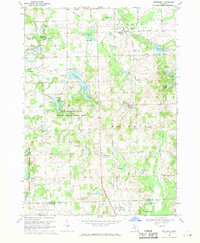
1968 Map of Metamora
USGS Topo · Published 1970About this map
Metamora sits at the heart of this Lapeer County landscape, where the Penn Central railroad cuts through a terrain defined by glacial lakes and headwaters. The map illustrates a transitional period in the late 1960s, showing the established village of Metamora and the smaller settlement of Thomas to the south. Extensive natural and recreational lands dominate the western half, specifically the Metamora-Hadley State Recreation Area, which encompasses Lake Minnawanna and Camp Metamora. The presence of numerous family-named burial grounds like Harris Cem, Schuneman Cem, and Farmers Creek Cem offers significant value for genealogical research, anchoring the mid-century landscape to its 19th-century pioneer roots. To the east, the South Branch Flint River winds through agricultural fields, while prominent elevations like Mt Christie rise above the surrounding lake-dotted plains.
Find a feature on this map
73 named features on this map. Tap any name to fly to it.
Don’t see what you’re looking for? This feature index may not catch every label — zoom into the map to look around manually.
Map Details
Editions of this 1968 Metamora Map
2 editions found
Other maps of this area

1943 · Ortonville
USGS Topo · 1:24,000

1943 · Lake Orion
USGS Topo · 1:24,000

1943 · Oxford
USGS Topo · 1:24,000

1943 · Metamora
USGS Topo · 1:24,000

1945 · Thornville
USGS Topo · 1:24,000

1945 · Oxford
USGS Topo · 1:24,000
1945 · Ortonville
USGS Topo · 1:24,000

1945 · Hadley
USGS Topo · 1:24,000
1945 · Lake Orion
USGS Topo · 1:24,000

1946 · Metamora
USGS Topo · 1:24,000
Featured Places
- Oxford Charter Township, MI
- Metamora, MI
- Brandon Charter Township, MI
- Hadley Township, MI
- Elba Township, MI