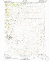
1972 Map of Metamora
USGS Topo · Published 1991About this map
Metamora serves as the central hub of this Woodford County landscape during the early 1970s, where the convergence of the Gulf Mobile and Ohio and Illinois Central railroads underscores the area's agricultural and transit history. The map detail highlights several small outlying settlements such as Cazenovia, Low Point, and Volz, which represent the shifting rural population centers of the era. A high concentration of family and community burial grounds, including Morristown Cem, Harmony Cem, and Gingrich Cem, provides significant value for genealogical research. The natural drainage of the region is defined by the headwaters of Partridge Creek and Walnut Creek, while Camp Manitoumi indicates the development of recreational land use alongside the traditional farming and extractive industry seen at the local Gravel Pit.
Find a feature on this map
23 named features on this map. Tap any name to fly to it.
Don’t see what you’re looking for? This feature index may not catch every label — zoom into the map to look around manually.
Map Details
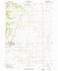
Editions of this 1972 Metamora Map
2 editions found
Other maps of this area

1893 · Metamora
USGS Topo · 1:62,500

1927 · Danvers
USGS Topo · 1:62,500

1928 · Mackinaw
USGS Topo · 1:62,500

1930 · Danvers
USGS Topo · 1:62,500

1932 · Mackinaw
USGS Topo · 1:62,500

1937 · Metamora
USGS Topo · 1:62,500

1948 · Metamora
USGS Topo · 1:62,500

1955 · Minonk
USGS Topo · 1:62,500

1958 · Peoria
USGS Topo · 1:250,000

1961 · Peoria
USGS Topo · 1:250,000