
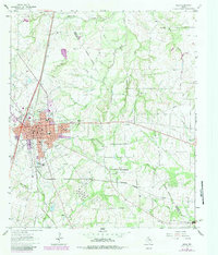
1963 Map of Mexia
USGS Topo · Published 1966About this map
Mexia serves as the central hub of this Limestone County landscape, showcasing the post-war expansion of its residential and educational infrastructure. The map details several local schools, including Dunbar High Sch, Ross Sch, and Douglas Sch, reflecting the community's mid-century social fabric. Beyond the city grid, the terrain is shaped by the Tehuacana Oil Field to the northwest and a network of watercourses like Tehuacana Creek and Salt Creek.
Find a feature on this map
43 named features on this map. Tap any name to fly to it.
Don’t see what you’re looking for? This feature index may not catch every label — zoom into the map to look around manually.
Map Details
Editions of this 1963 Mexia Map
2 editions found
Other maps of this area

1920 · Mexia
USGS Topo · 1:62,500

1954 · Waco
USGS Topo · 1:250,000

1955 · Waco
USGS Topo · 1:250,000

1957 · Groesbeck
USGS Topo · 1:62,500

1960 · Groesbeck
USGS Topo · 1:24,000

1960 · Tehuacana
USGS Topo · 1:24,000

1963 · Wortham
USGS Topo · 1:24,000

1963 · Teague North
USGS Topo · 1:24,000

1963 · Kirvin
USGS Topo · 1:24,000
1965 · Union High
USGS Topo · 1:24,000