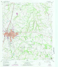
1963 Map of Mexia
USGS Topo · Published 1983About this map
Mexia serves as the focal point of this regional study, which illustrates the area's development from the early 1960s through revisions in the early 1980s. The landscape is defined by its industrial and agricultural roots, notably the Tehuacana Oil Field in the northwest and a dense network of pipelines. Traces of older communities and rural life are scattered throughout, including Springfield to the south and Point Enterprise to the east. The map documents the local educational and spiritual infrastructure with Ross Sch, Douglas Sch, and several family and community burial grounds such as New Home Cem and Valley Cem. Geographically, the area is drained by Tehuacana Creek and Elm Creek, while the presence of the Southern Pacific and Burlington Northern railroads highlights the importance of rail transport to the local economy.
Find a feature on this map
50 named features on this map. Tap any name to fly to it.
Don’t see what you’re looking for? This feature index may not catch every label — zoom into the map to look around manually.
Map Details
Editions of this 1963 Mexia Map
2 editions found
Other maps of this area

1920 · Mexia
USGS Topo · 1:62,500

1954 · Waco
USGS Topo · 1:250,000

1955 · Waco
USGS Topo · 1:250,000

1957 · Groesbeck
USGS Topo · 1:62,500

1960 · Groesbeck
USGS Topo · 1:24,000

1960 · Tehuacana
USGS Topo · 1:24,000

1963 · Wortham
USGS Topo · 1:24,000

1963 · Teague North
USGS Topo · 1:24,000

1963 · Kirvin
USGS Topo · 1:24,000

1963 · Mexia
USGS Topo · 1:24,000