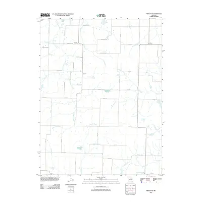
2012 Map of Mexico SE
USGS Topo · Published 2012About this map
Lockridge Cemetery and Unity Cemetery anchor the rural landscape of southeast Audrain County, reflecting the deep-rooted family lineages of this agricultural region. The terrain is defined by a complex drainage system where the South Fork Salt River and Shattering Fork converge in the northwest, while the West Fork Cuivre River and the Loutre River headwaters emerge to the east. This 2012 survey illustrates a modern grid of county roads, such as Audrain Road 824 and State Road B, which facilitate movement between scattered farmsteads and man-made water features like the Number 222 Reservoir and Don Woods Lake. The map captures a moment of transition where traditional land use meets contemporary water management, seen in the numerous small ponds and the course of Harrison Branch as it winds toward the southern border.
Find a feature on this map
54 named features on this map. Tap any name to fly to it.
Don’t see what you’re looking for? This feature index may not catch every label — zoom into the map to look around manually.
Map Details
Editions of this 2012 Mexico SE Map
This is the sole edition of this map. No revisions or reprints were ever made.
Other maps of this area

1890 · Mexico
USGS Topo · 1:125,000

1890 · Fulton
USGS Topo · 1:125,000

1928 · Fulton
USGS Topo · 1:62,500

1931 · Fulton
USGS Topo · 1:62,500

1932 · Mexico
USGS Topo · 1:62,500

1940 · Montgomery City
USGS Topo · 1:62,500

1942 · Montgomery City
USGS Topo · 1:62,500

1942 · Wellsville
USGS Topo · 1:62,500

1948 · Quincy
USGS Topo · 1:250,000

1949 · Saint Louis
USGS Topo · 1:250,000