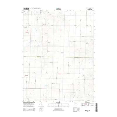
2014 Map of Mexico SE
USGS Topo · Published 2014About this map
The headwaters of several major regional drainage systems converge along the Audrain Co Callaway Co boundary, where the landscape is defined by a dense network of creeks and small rivers. This area in central Missouri serves as a hydrologic divide, feeding the S Fork Salt River to the northwest, the W Fork Cuivre River to the northeast, and the Loutre River and Bachelor Cr to the south. The rural character of the region is punctuated by numerous family and community burial grounds, including Lockridge Cemetery, New Hope Cemetery, and Pleasant Grove Cemetery. Scattered water features like Don Woods Lake, Ed Whalen Lake, and the uniquely named Number 222 Reservoir appear alongside a grid of county roads that have shaped the agricultural settlement patterns between Mexico and the Callaway County line.
Find a feature on this map
96 named features on this map. Tap any name to fly to it.
Don’t see what you’re looking for? This feature index may not catch every label — zoom into the map to look around manually.
Map Details
Editions of this 2014 Mexico SE Map
This is the sole edition of this map. No revisions or reprints were ever made.
Other maps of this area

1890 · Mexico
USGS Topo · 1:125,000

1890 · Fulton
USGS Topo · 1:125,000

1928 · Fulton
USGS Topo · 1:62,500

1931 · Fulton
USGS Topo · 1:62,500

1932 · Mexico
USGS Topo · 1:62,500

1940 · Montgomery City
USGS Topo · 1:62,500

1942 · Montgomery City
USGS Topo · 1:62,500

1942 · Wellsville
USGS Topo · 1:62,500

1948 · Quincy
USGS Topo · 1:250,000

1949 · Saint Louis
USGS Topo · 1:250,000