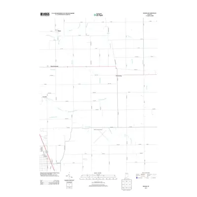
2013 Map of Miami
USGS Topo · Published 2013About this map
Miami and Bennetts Switch anchor this agricultural landscape in north-central Indiana, where a dense network of drainage channels illustrates the region's managed hydrology. Small rural clusters like Wawpecong and Cassville are linked by a precise grid of county roads, showing the persistent settlement patterns of the late twentieth and early twenty-first centuries. The importance of agricultural land management is evident in the numerous named waterways, including Klise Ditch, Wise Ditch, and Grinslade Ditch, which channel water toward natural courses like Deer Cr. To the south, the Kokomo Municipal Airport represents a modern transition from the surrounding farmsteads. The confluence of named ditches such as the Matthew-Anaker Ditch and the winding S Fork Deer Cr highlights the complex intersection of man-made irrigation and natural creek beds in this part of Howard and Miami Counties.
Find a feature on this map
77 named features on this map. Tap any name to fly to it.
Don’t see what you’re looking for? This feature index may not catch every label — zoom into the map to look around manually.
Map Details
Editions of this 2013 Miami Map
This is the sole edition of this map. No revisions or reprints were ever made.
Other maps of this area

1951 · Onward
USGS Topo · 1:24,000

1951 · Bunker Hill
USGS Topo · 1:24,000

1953 · Peoria
USGS Topo · 1:24,000

1953 · Danville
USGS Topo · 1:250,000

1953 · Muncie
USGS Topo · 1:250,000

1955 · Danville
USGS Topo · 1:250,000

1956 · Muncie
USGS Topo · 1:250,000

1956 · Danville
USGS Topo · 1:250,000

1959 · Galveston
USGS Topo · 1:24,000

1959 · Miami
USGS Topo · 1:24,000