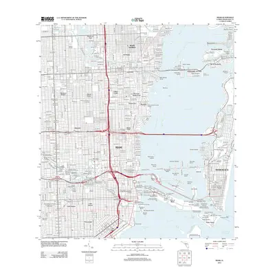
2012 Map of Miami
USGS Topo · Published 2012About this map
Biscayne Bay and the complex waterways of the Intracoastal Waterway define this coastal landscape during a period of dense urban growth. The map illustrates the intensive development of the harbor, from the Cruise Ship Docks Port of Miami on Dodge Island to the industrial waterfront activities at the Bimini Shipping Wharf and Slip. The urban grid is established across historic neighborhoods such as Lemon City, Allapattah, and Little River, while the Florida East Coast RR remains a primary transit corridor through the city center.
Find a feature on this map
145 named features on this map. Tap any name to fly to it.
Don’t see what you’re looking for? This feature index may not catch every label — zoom into the map to look around manually.
Map Details
Editions of this 2012 Miami Map
This is the sole edition of this map. No revisions or reprints were ever made.
Other maps of this area

1947 · North Miami
USGS Topo · 1:24,000

1947 · Key Biscayne
USGS Topo · 1:24,000

1949 · Opalocka
USGS Topo · 1:24,000

1949 · Key Biscayne
USGS Topo · 1:24,000

1950 · Hialeah
USGS Topo · 1:24,000

1950 · Miami
USGS Topo · 1:24,000

1950 · North Miami
USGS Topo · 1:24,000

1950 · South Miami
USGS Topo · 1:24,000

1956 · South Miami
USGS Topo · 1:24,000

1956 · Miami
USGS Topo · 1:250,000