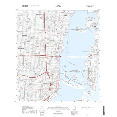
2021 Map of Miami
USGS Topo · Published 2021About this map
The urban landscape of Miami and Miami Beach is defined by an intricate network of waterways and bridges connecting the mainland to various islands. Dense residential developments across Buena Vista, Edison Center, and Lemon City reflect the long-standing growth of the metropolitan core. To the east, the Intracoastal Waterway separates the city from residential island enclaves like the Isle of Normandy and La Gorce Island. Civil infrastructure is prominently clustered near the mouth of the Miami River, where the Dade County Courthouse and Richard E Gerstein Justice Building anchor the downtown district.
Find a feature on this map
108 named features on this map. Tap any name to fly to it.
Don’t see what you’re looking for? This feature index may not catch every label — zoom into the map to look around manually.
Map Details
Editions of this 2021 Miami Map
This is the sole edition of this map. No revisions or reprints were ever made.
Other maps of this area

1947 · North Miami
USGS Topo · 1:24,000

1947 · Key Biscayne
USGS Topo · 1:24,000

1949 · Opalocka
USGS Topo · 1:24,000

1949 · Key Biscayne
USGS Topo · 1:24,000

1950 · Hialeah
USGS Topo · 1:24,000

1950 · Miami
USGS Topo · 1:24,000

1950 · North Miami
USGS Topo · 1:24,000

1950 · South Miami
USGS Topo · 1:24,000

1956 · South Miami
USGS Topo · 1:24,000

1956 · Miami
USGS Topo · 1:250,000