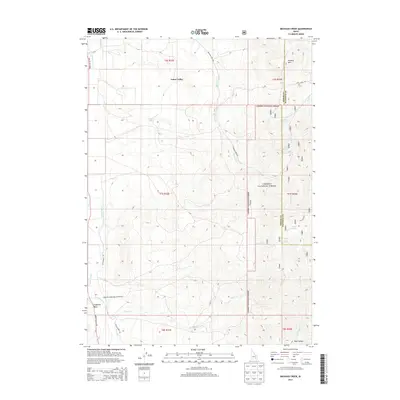
2013 Map of Michaud Creek
USGS Topo · Published 2013About this map
Arbon Valley occupies the heart of this landscape, where agricultural infrastructure and rugged terrain meet at the border of Caribou National Forest. The map documents a complex system of water management essential for high-elevation farming, featuring the Toghee Canal, School Lateral, and the Two Ditch system. These irrigation works channel water toward the Bannock Creek Farm Station Rd, illustrating the intensive land use in this part of Power and Bannock Counties. To the east, the terrain rises sharply toward Howard Mtn and the numerous springs of the national forest, including Wildcat Spring and Outlaw Spring. The presence of landmarks like Eagletail Rock and isolated water sources like Horse Lake highlights the remote character of this Idaho backcountry in the early 21st century.
Find a feature on this map
32 named features on this map. Tap any name to fly to it.
Don’t see what you’re looking for? This feature index may not catch every label — zoom into the map to look around manually.
Map Details
Editions of this 2013 Michaud Creek Map
This is the sole edition of this map. No revisions or reprints were ever made.
Other maps of this area

1934 · Michaud
USGS Topo · 1:62,500

1937 · Pocatello
USGS Topo · 1:48,000

1937 · Michaud
USGS Topo · 1:62,500

1938 · Pauline
USGS Topo · 1:48,000

1944 · Pocatello
USGS Topo · 1:62,500

1944 · Arbon
USGS Topo · 1:62,500

1954 · Pocatello
USGS Topo · 1:250,000

1958 · Pocatello
USGS Topo · 1:250,000

1968 · Clifton Creek
USGS Topo · 1:24,000
1971 · Pocatello North
USGS Topo · 1:24,000