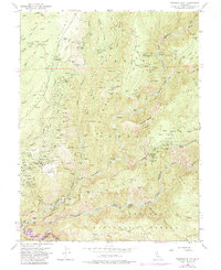
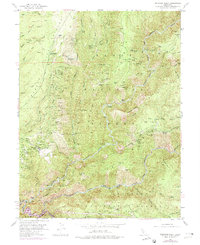
1952 Map of Michigan Bluff
USGS Topo · Published 1984About this map
Michigan Bluff sits perched above the deep canyons of the Middle Fork American River, a location defined by its intensive gold mining history. The landscape is etched with the remnants of hydraulic and underground operations, including the Hidden Treasure Mine, Mountain Chief Mine, and the Beehive Mine. Many locations are noted only by their historical footprints, such as Deadwood and Ditch Camp, reflecting the transient nature of the gold camps in the Tahoe National Forest. The map reveals a complex network of resource extraction through numerous shafts and pits like the Franklin Pit and Bachelor Pit. Steep ridgelines, including Chicken Hawk Ridge and Deadwood Ridge, separate the river branches where river bars such as Stoney Bar and Indian Bar were once centers of activity. The presence of the Chicken Hawk Campground and various trails suggests the area's transition from an industrial mining hub to a site for recreation and forest management.
Find a feature on this map
133 named features on this map. Tap any name to fly to it.
Don’t see what you’re looking for? This feature index may not catch every label — zoom into the map to look around manually.
Map Details
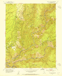
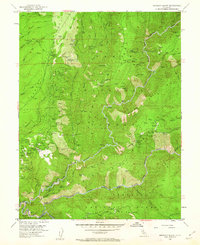
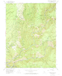
Editions of this 1952 Michigan Bluff Map
7 editions found
Other maps of this area

1891 · Colfax
USGS Topo · 1:125,000

1891 · Placerville
USGS Topo · 1:125,000

1892 · Placerville
USGS Topo · 1:125,000

1892 · Colfax
USGS Topo · 1:125,000

1893 · Placerville
USGS Topo · 1:125,000

1894 · Colfax
USGS Topo · 1:125,000

1898 · Colfax
USGS Topo · 1:125,000

1900 · Colfax
USGS Topo · 1:125,000

1902 · Colfax
USGS Topo · 1:125,000

1938 · Colfax
USGS Topo · 1:125,000