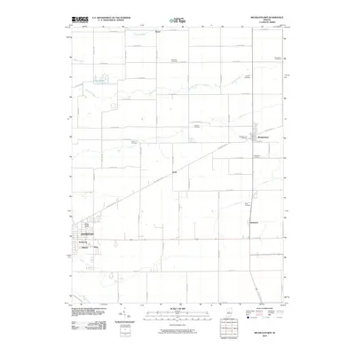
2010 Map of Michigantown
USGS Topo · Published 2010About this map
Michigantown and the eastern outskirts of Frankfort anchor this 2010 survey of central Indiana farmland. The landscape is defined by a dense grid of rural roads and the diagonal path of Washington Ave, which cuts across the township towards Boyleston. This area is particularly rich for genealogical research, documenting numerous small burial grounds such as Old Whiteman Cemetery, Hopewell Cemeteries, and Layman Cemetery that dot the agricultural parcels between Kilmore Creek and Campbells Run. Smaller residential clusters like Avery, Beard, and the neighborhoods of Kentwood and Wilshire provide a detailed view of local settlement patterns at the start of the 21st century. The map also traces a series of drainage systems essential to the region's farming, including Jenkins Ditch and Talbert Ditch, which channel water through the flat terrain toward larger tributaries.
Find a feature on this map
64 named features on this map. Tap any name to fly to it.
Don’t see what you’re looking for? This feature index may not catch every label — zoom into the map to look around manually.
Map Details
Editions of this 2010 Michigantown Map
This is the sole edition of this map. No revisions or reprints were ever made.
Other maps of this area

1953 · Danville
USGS Topo · 1:250,000

1955 · Danville
USGS Topo · 1:250,000

1956 · Danville
USGS Topo · 1:250,000

1961 · Michigantown
USGS Topo · 1:24,000

1961 · Russiaville
USGS Topo · 1:24,000

1961 · Mechanicsburg
USGS Topo · 1:24,000

1961 · Hillisburg
USGS Topo · 1:24,000

1961 · Rossville
USGS Topo · 1:24,000

1961 · Burlington
USGS Topo · 1:24,000

1961 · Frankfort
USGS Topo · 1:24,000