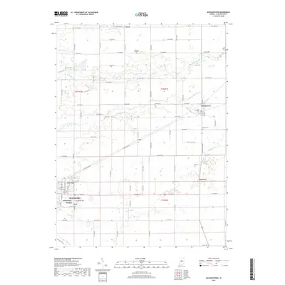
2019 Map of Michigantown
USGS Topo · Published 2019About this map
Michigantown and the eastern edge of Frankfort anchor this 2019 survey of eastern Clinton County, Indiana. The landscape is defined by a dense grid of county roads that carve the agricultural terrain into precise sections, a layout typical of the Midwest's rural development. Waterways like Kilmore Creek and the S Fork Wildcat Cr meander through the farmland, providing natural drainage and shaping the local topography. For those tracing local families, the map includes numerous small burial grounds including Hopewell Cemeteries, Laymon Cem, and Old Liberty Cem. These sites, along with small rail-aligned communities such as Boyleston and Avery, reflect the historical settlement patterns of the region. The transition from the residential neighborhoods of Kentwood and Wilshire in the west to the open acreage of the east highlights the intersection of municipal growth and rural heritage.
Find a feature on this map
87 named features on this map. Tap any name to fly to it.
Don’t see what you’re looking for? This feature index may not catch every label — zoom into the map to look around manually.
Map Details
Editions of this 2019 Michigantown Map
This is the sole edition of this map. No revisions or reprints were ever made.
Other maps of this area

1953 · Danville
USGS Topo · 1:250,000

1955 · Danville
USGS Topo · 1:250,000

1956 · Danville
USGS Topo · 1:250,000

1961 · Michigantown
USGS Topo · 1:24,000

1961 · Russiaville
USGS Topo · 1:24,000

1961 · Mechanicsburg
USGS Topo · 1:24,000

1961 · Hillisburg
USGS Topo · 1:24,000

1961 · Rossville
USGS Topo · 1:24,000

1961 · Burlington
USGS Topo · 1:24,000

1961 · Frankfort
USGS Topo · 1:24,000