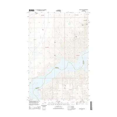
2014 Map of Mickey Butte
USGS Topo · Published 2014About this map
The Missouri River winds through this Central Montana landscape, marking the boundary between Phillips and Garfield counties at the U L Bend. This area is defined by the expansive waters of Fort Peck Lake, which submerge the lowlands and create a complex shoreline against the surrounding breaks. Higher ground is anchored by prominent landforms such as Mickey Butte and Brandon Butte, while Tripp Divide separates the drainage basins in the southern portion of the sheet. The terrain is deeply incised by numerous coulees, including Cart Coulee and Mickus Coulee, which serve as intermittent waterways feeding into the river system. Local water management is evident through features like Mary Reservoir and Eva May Reservoir, supporting the open rangeland characteristic of Hawley Flat.
Find a feature on this map
25 named features on this map. Tap any name to fly to it.
Don’t see what you’re looking for? This feature index may not catch every label — zoom into the map to look around manually.
Map Details
Editions of this 2014 Mickey Butte Map
This is the sole edition of this map. No revisions or reprints were ever made.
Other maps of this area

1954 · Jordan
USGS Topo · 1:250,000

1956 · Jordan
USGS Topo · 1:250,000

1958 · Jordan
USGS Topo · 1:250,000

1964 · Jordan
USGS Topo · 1:250,000

1965 · Germaine Coulee East
USGS Topo · 1:24,000

1965 · Germaine Coulee West
USGS Topo · 1:24,000

1965 · Lost Creek
USGS Topo · 1:24,000

1965 · Herman Point
USGS Topo · 1:24,000

1965 · Locke Ranch
USGS Topo · 1:24,000

1965 · Cap Rock Butte
USGS Topo · 1:24,000