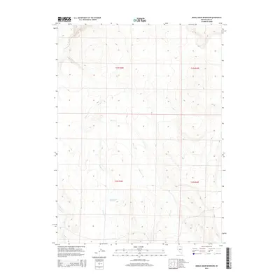
2014 Map of Middle Draw Reservoir
USGS Topo · Published 2014About this map
Middle Draw Reservoir serves as a central hydrological landmark in this high-elevation corner of Elko County, Nevada. The landscape is defined by a network of seasonal drainage patterns, where Winters Cr and Threemile Cr descend from the surrounding upland ridges toward the reservoir. The topography across townships T43N R48E and T42N R48E reveals the natural contours of the Great Basin watershed, including the upper reaches of Chimney Cr in the northwest. This 2014 survey documents the modern state of these remote water resources and the Public Land Survey System grid that organizes this vast grazing or mining territory, illustrating how water management remains the primary human imprint on this arid terrain.
Find a feature on this map
8 named features on this map. Tap any name to fly to it.
Don’t see what you’re looking for? This feature index may not catch every label — zoom into the map to look around manually.
Map Details
Editions of this 2014 Middle Draw Reservoir Map
This is the sole edition of this map. No revisions or reprints were ever made.
Other maps of this area

1955 · McDermitt
USGS Topo · 1:250,000

1956 · Mt. Blitzen
USGS Topo · 1:62,500

1959 · McDermitt
USGS Topo · 1:250,000

1964 · Wilson Reservoir
USGS Topo · 1:62,500

1974 · Soldier Cap
USGS Topo · 1:24,000

1974 · Middle Draw Reservoir
USGS Topo · 1:24,000

1974 · Winters Ranch Reservoir
USGS Topo · 1:24,000

1974 · Burner Hills
USGS Topo · 1:24,000

1974 · Desert Ranch
USGS Topo · 1:24,000
1977 · Silver Lake
USGS Topo · 1:24,000