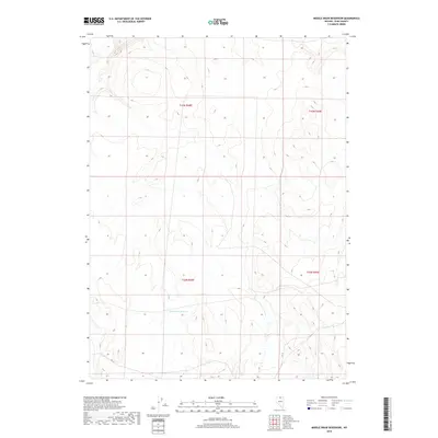
2018 Map of Middle Draw Reservoir
USGS Topo · Published 2018About this map
Middle Draw Reservoir sits at the center of this 2018 topographic study of northern Elko County, marking a vital water source in an otherwise high-desert expanse. The landscape is defined by the rigid grid of the Public Land Survey System, specifically detailing portions of t43n r48e, t43n r49e, t42n r48e, and t42n r49e. This map reveals the essential infrastructure of modern land management in Nevada, where sparse local roads and 4WD tracks navigate the terrain between these township and range boundaries. The absence of named settlements or civic structures highlights the character of this region as a dedicated space for resource management and ranching at the start of the twenty-first century.
Find a feature on this map
5 named features on this map. Tap any name to fly to it.
Don’t see what you’re looking for? This feature index may not catch every label — zoom into the map to look around manually.
Map Details
Editions of this 2018 Middle Draw Reservoir Map
This is the sole edition of this map. No revisions or reprints were ever made.
Other maps of this area

1955 · McDermitt
USGS Topo · 1:250,000

1956 · Mt. Blitzen
USGS Topo · 1:62,500

1959 · McDermitt
USGS Topo · 1:250,000

1964 · Wilson Reservoir
USGS Topo · 1:62,500

1974 · Soldier Cap
USGS Topo · 1:24,000

1974 · Middle Draw Reservoir
USGS Topo · 1:24,000

1974 · Winters Ranch Reservoir
USGS Topo · 1:24,000

1974 · Burner Hills
USGS Topo · 1:24,000

1974 · Desert Ranch
USGS Topo · 1:24,000
1977 · Silver Lake
USGS Topo · 1:24,000