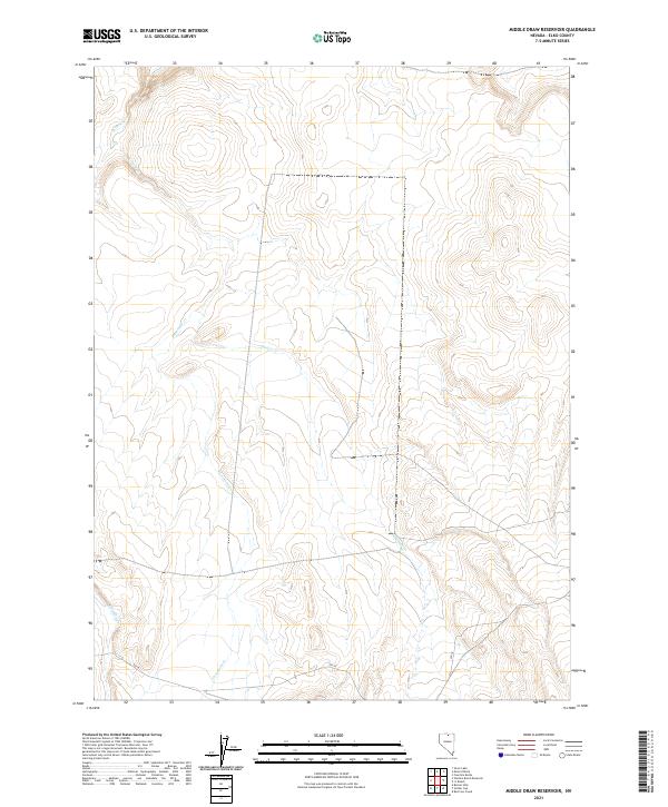
2021 Map of Middle Draw Reservoir
USGS Topo · Published 2021About this map
Winters Cr and Threemile Cr thread through this expansive section of Elko County, defining a landscape shaped by high-desert drainage patterns. The 2021 survey highlights the remote character of this region, where water sources like Chimney Cr are the primary landmarks across the township lines of t43n r48e and t42n r49e. The map reveals a sparse infrastructure, with the presence of SSR 18 in the southern portion providing the principal artery for movement through the territory. This map documents the precise hydrography and elevation of the Middle Draw Reservoir quadrangle, serving as a modern record of the natural contours and limited human imprints in this part of northern Nevada.
Find a feature on this map
8 named features on this map. Tap any name to fly to it.
Don’t see what you’re looking for? This feature index may not catch every label — zoom into the map to look around manually.
Map Details
Editions of this 2021 Middle Draw Reservoir Map
This is the sole edition of this map. No revisions or reprints were ever made.
Other maps of this area

1955 · McDermitt
USGS Topo · 1:250,000

1956 · Mt. Blitzen
USGS Topo · 1:62,500

1959 · McDermitt
USGS Topo · 1:250,000

1964 · Wilson Reservoir
USGS Topo · 1:62,500

1974 · Soldier Cap
USGS Topo · 1:24,000

1974 · Middle Draw Reservoir
USGS Topo · 1:24,000

1974 · Winters Ranch Reservoir
USGS Topo · 1:24,000

1974 · Burner Hills
USGS Topo · 1:24,000

1974 · Desert Ranch
USGS Topo · 1:24,000
1977 · Silver Lake
USGS Topo · 1:24,000