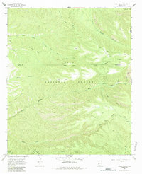
1965 Map of Middle Mesa
USGS Topo · Published 1984About this map
Gila National Forest terrain dominates this mid-1960s survey, revealing a landscape defined by deep drainages and cattle-ranching infrastructure at the high-elevation borders of Grant, Catron, and Sierra Counties. The map captures a transition between traditional ranching life and modern aviation needs, evidenced by the presence of the Me Own Landing Strip and a nearby Heliport situated on Middle Mesa. Remote outposts like the Diamond Bar Ranch sit nestled within complex canyon systems such as South Diamond Creek and Tom Moore Canyon. Historical movement through this territory is traced along established routes like the Community Pasture Trail and the Brannon Park Trail, which connect vital water sources like Meason Spring and Meason Flat. The intricate topography of Tom Moore Mesa and various corrals scattered across the quadrangle emphasize the area's continued reliance on the land's natural contours for livestock management.
Find a feature on this map
25 named features on this map. Tap any name to fly to it.
Don’t see what you’re looking for? This feature index may not catch every label — zoom into the map to look around manually.
Map Details
Editions of this 1965 Middle Mesa Map
2 editions found
Other maps of this area

1911 · Alum Mountain
USGS Topo · 1:125,000

1913 · Alum Mountain
USGS Topo · 1:125,000

1949 · Lookout Mountain
USGS Topo · 1:62,500

1954 · Tularosa
USGS Topo · 1:250,000

1954 · Clifton
USGS Topo · 1:250,000

1957 · Clifton
USGS Topo · 1:250,000

1958 · Clifton
USGS Topo · 1:250,000

1958 · Tularosa
USGS Topo · 1:250,000

1962 · Clifton
USGS Topo · 1:250,000

1963 · Bonner Canyon
USGS Topo · 1:24,000